Wednesday, June 29, 2011

Peggy's Cove, Nova Scotia

Today we drove 240 miles back to the southwest to Peggy's Cove just west of Halifax on the south shore of Nova Scotia. About 1/2 of the rte was back tracking the rte we were on when we went to Cape Breton Island. As we neared Halifax we began seeing a lot of farms and did see some corn that was in the 2 leaf stage.
It was much warmer today but at Halifax if became foggy and the temp dropped 15 degree's. Today's pictures are of a couple of the white wooden church's that are in nearly every little town that you come to. They are all neatly maintained and well painted. The two steeple is a Catholic church at North Sydney and the other is a Presbyterian on the Cabot trail.

Tuesday, June 28, 2011

Alexander Graham Bell National Historic site

Today was the first sunny warm day we have enjoyed while here in Nova Scotia. We visited the Alexander graham Bell Historic site here in Baddeck. Bell was born in Scotland, however he moved with his parents at a young age to Ontario because of the ill health of he and his siblings. His life long passion was education of the deaf. He taught the deaf in Boston and invented a device to help them hear and talk as well as the telephone. He married one of his deaf students. After achieving financial success he and his family built a summer home at Baddeck, Nova Scotia. The hills and trees and water reminded him of his beloved Scotland. He was a man who would spend hours thinking about how he could make things happen. He took the Wright Bros. airplane invention and added aerleons and had the first motorized airplane flight in Canada in 1909. He figured that if boats could raise out of the water that they would move much faster. He along with a young engineer that was like a son to him developed the hydra-foil boat during WW1. However the war ended and it never caught on. He also invented many other things including instruments for measuring airflow. His most cherished invention was a glass tingle enclosure in which he would put salt water from the Bras d-Or lake. The sun would condense it on the sides and the water that dripped off would be pure drinking water.

Monday, June 27, 2011

Fortress of Louisbourg


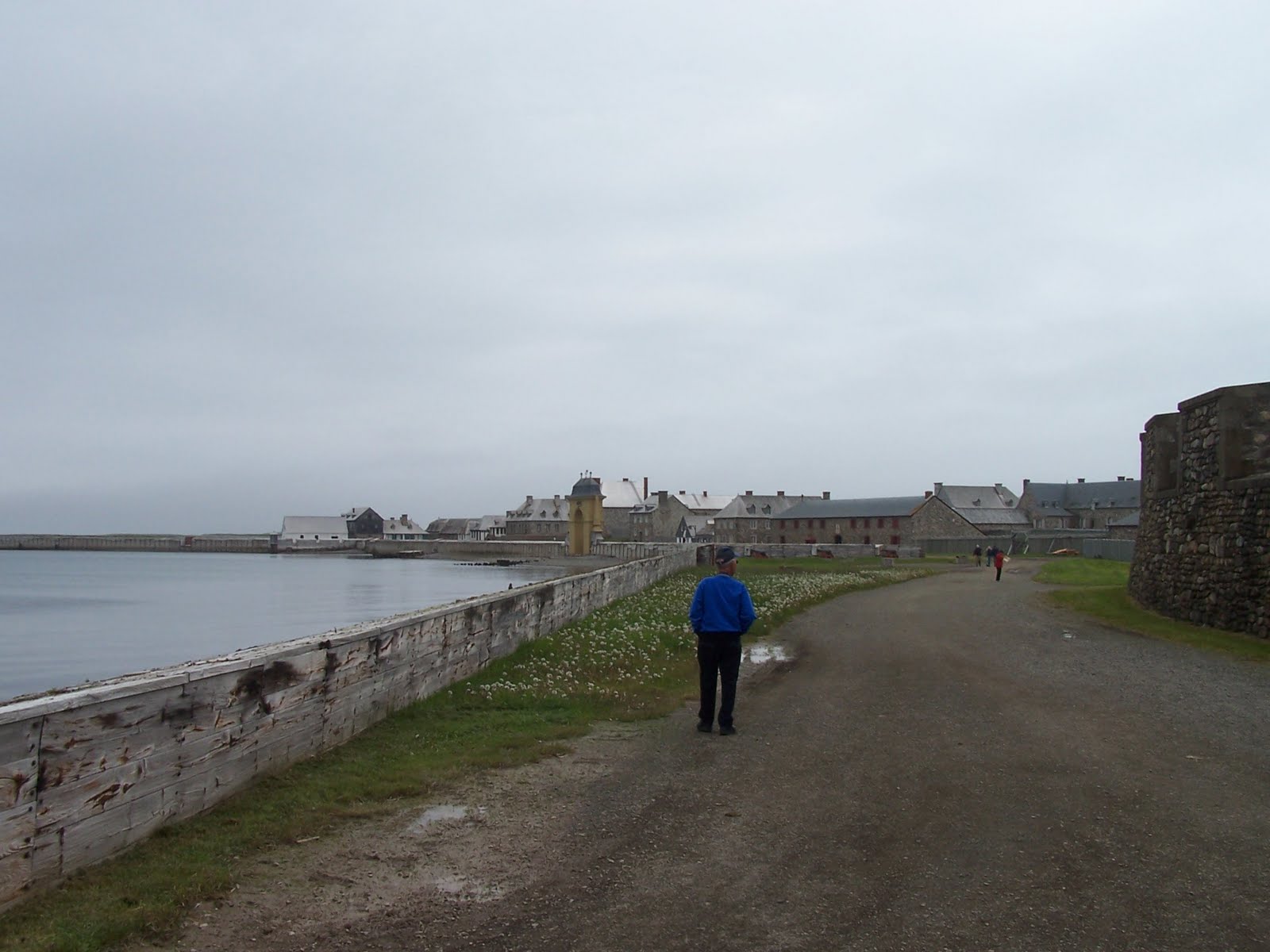
Today we made the trip across St Ann's Bay through Syndey to the Fortress of Louisbourg on the extreme south east side of Cape Breton Island. A trip of around 65 miles one way. The Fortress is a the largest reconstructed 18th century town in North America. It existed from 1730's to 1760 when it was destroyed by the English who had taken it from the French. Reconstruction started in the 1960's and some of the buildings contain the original cobblestone floors and rock walls. It was a French held fortress with a population of 1500 up to 3000 depending on how many ships were in port.
The major export to France was fish a high percentage of which were Cod. Nearly all of their products they used for their existence were imported from France. Many of the buildings have people in period dress that talk to you as if you are actually there in that time in history. We had lunch in one of the buildings where we ate from old pewter bowls and spoons. We tied large square bibs around our necks while we ate. We had beef stew, bread baked from a period recipe in a large wood fired oven daily, and a sugar cookie. On the way back we drove through down town Sydney located on the water front. A fortress is a walled settlement of people along with a military encampment and a fort is just a walled military encampment.

Baddeck, Nova Scotia

Sun. we awoke to cloudy drizzly weather. We started toward Sydney but due to the poor visibility we decided to wait a day. Turning down a road that said ferry to Cabot Trail we came upon this two deck bus that had been converted to a cafe. We stopped and had tea as we sat on the top deck watching the ferry and talking to some of the local people.
We then drove into Baddeck a fishing town located on Bras d"or Lake which is connected to the Atlantic ocean by St Anns Bay. The rest of the day was spent doing laundry and repairs.

Saturday, June 25, 2011

Cabot Trail


Brr 49 degree this morning & 55 when we got back this afternoon. It was also cloudy damp and windy. After we crossed the Conso Causeway yesterday we are on what they call the Cape Breton Island the northeastern part of Nova Scotia. Today we did the Cabot Trail loop it is the northern part of the Island. It has been called one of the 7 wonders of the world as well as one of the most scenic drives in the world. It is a 190 mile drive up the east coast with views of the Atlantic Oceans rocky bays and then up over tree covered mountains to elevations as high as 1400 ft.
We passed through small fishing villages and saw many boats out checking their lobster traps. We stopped for lunch at the small fishing village of Neil's Harbor where we enjoyed one of the better meals of our trip at the Clam Chowder restaurant. It was in a small building overlooking the Atlantic ocean next to a light house. As we rounded the top of the Island and began coming down the west side we had many more scenic overlooks both over the Gulf of Saint Lawrence and up the tree covered valleys into the mountains.
Near Cape Le Moine we came across this quirky display called joe's scarecrow Village. It consisted of 50 or 60 scarecrows that had masks of famous people as well as just ordinary Halloween masks. They were dressed in bright cloths or cloths to match the mask and most had names as well as some saying pinned to them. Surprisingly this drive is not very commercialized, it does have a lot of small pottery shops and craft shops run by Celtic people that live in the area.

Friday, June 24, 2011

Baddeck, Nova Scotia

This morning we left Moncton, NB headed southeast entering Nova Scotia we stopped at the welcome center to pick up tour books, maps and advice as to what to see. We then continue east southeast on highway 104 through the gently rolling wooded hills seeing occasional hay meadows. Around Truro it became more winding , wooded and forested. Turning due east toward New Glasco on rte. 4 it became flatter and we saw some farm land with many small fields a few planted to crops but mostly hay fields.


Traveling on east it became more forested and we met many trucks hauling logs. After passing Antigonish we began catching glimpses of the
St George Bay to our left. Crossing the Canso Causeway at Port Hastings we turned northeast on rt 105. We had been noticing the change in the trees along the way to more deciduous but as we traveled north they became predominately Spruce.
As we passed around an arm of the Bras d'or Lake at Whycocomagh we could see a beautiful old wooden church across the water. In a few more miles we arrived at the Cabot Trail campground at Baddeck. We traveled around 250 miles today. We will sight see from here for a couple of days.

Hopewell Cape

Yesterday we drove about 35 miles south to Hopewell Cape where the flower pot rocks are located. This is on the Bay of Fundy between New Brunswick & Nova Scotia. The tide in this area rises 40 feet in 6 hrs. from low tide to high tide. The picture shows some of the flower pot rocks at low tide, notice the people walking around. We went down 95 steps to get down there. The park was closed by high tide so we can only imagine what it would look like with the water 35 ft. higher near the base of the trees.
We then drove another 30 miles along the coast of the bay passing through small coastal towns and by small hilly meadows with views of the bay at low tide. We stopped at the small fishing village of Alma, NB ate lunch and browsed the few shops. The picture is of fishing boats in the harbor at low tide. At high tide there is water at least 1/2 way up the shore walls in the marina and these boats are floating.